Prievidza
The oficial site of the Prievidza city
www.Prievidza.sk
About Prievidza city:
Geography
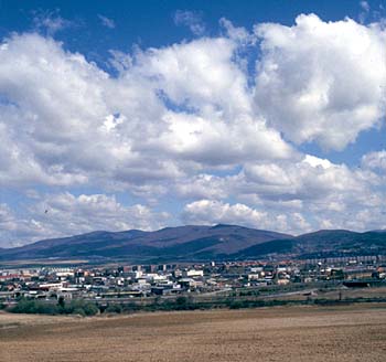 48° 46´ N. latitude, 18° 36´E longitude, 260 meters above sea level (ranging from 257 - 887 m). Area: 4,306 hectares, of which 1,753 hectares is agricultural, 1,530 hectares is forested land and 48 hectares is water. Mean annual temperature in 1973 - 2000 was 9°C, the warmest month is July (mean temperature 18.9°C), while the coldest month is January (mean temperature -1.6°C). Annual precipitation: 637 mm.
The city is divided into five administrative districts: Staré Mesto (Old City), Píly, Necpaly, Kopanice and the combined neighborhoods of Hradec, Malá Lehôtka and Veľká Lehôtka. The suburban neighborhoods have the character of country villages.
Stránky prevádzkuje
Mesto Prievidza
Námestie slobody č. 14, 971 01 PRIEVIDZA
Tel.:.+421/0/46/51 79 110 | Fax: +421/0/46/542 34 74
Webmaster
Created by © 2008 WebCreative.info
All rights reserved.